

AI in Action for Europe’s Largest LiDAR Project: The Digital Twin of Germany
Building the Digital Twin of Germany with AI-Powered Point Cloud Classification
A digital twin of an entire country requires more than collecting geospatial data. It requires the ability to transform enormous volumes of raw sensor data into structured, accurate, and usable information.
The Digital Twin of Germany represents an ambitious step toward a comprehensive digital representation of the country’s physical environment. With more than 70,000 km² of national-scale aerial LiDAR coverage, the project demonstrates the potential of combining large-scale geospatial data acquisition with advanced AI-powered processing.
Pointly contributes its expertise in automated 3D point cloud classification, helping transform complex LiDAR datasets into structured information that can support modern mapping, geospatial analysis, and digital twin applications.
From Raw LiDAR Data to Structured Geospatial Information
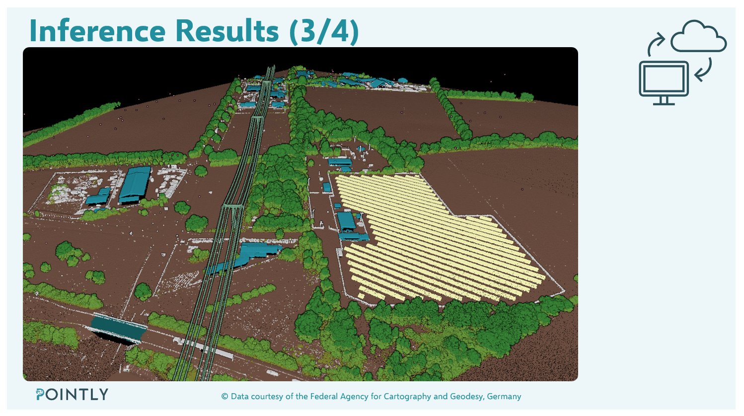
Aerial LiDAR surveys generate highly detailed 3D point clouds that capture the shape and structure of the physical environment. However, raw point clouds are not automatically ready for downstream applications. Individual points must be classified into meaningful categories, such as ground, buildings, vegetation, and other relevant objects.
Traditionally, this process can require substantial manual effort. At the scale of a national mapping project, conventional workflows become challenging in terms of processing time, consistency, and scalability.
Pointly addresses this challenge with AI-powered point cloud classification. Its technology automatically identifies and classifies objects within complex 3D datasets, transforming unstructured point clouds into organized geospatial data.
AI That Scales to National Coverage
Processing LiDAR data across more than 70,000 km² requires workflows that can handle large data volumes while maintaining consistent classification quality.
Pointly’s AI-driven approach enables extensive datasets to be processed efficiently, delivering classification results within hours for suitable workflows and data volumes. Automated processing reduces manual workloads and supports repeatable, scalable production pipelines.
The approach combines pretrained AI models with data-driven optimization to address the characteristics and requirements of specific datasets. Representative training data and systematic validation help improve model performance and ensure that the resulting classifications meet the needs of the intended application.
Enabling New Geospatial Applications
Accurately classified 3D point clouds provide a foundation for a wide range of geospatial applications. Structured data can support terrain analysis, infrastructure mapping, vegetation assessment, urban planning, and the development of digital representations of the built and natural environment.
Beyond classification, automated vectorization and feature extraction can transform point cloud information into structured geometries and objects for use in GIS and other downstream workflows.
By reducing the effort required to process and interpret large-scale 3D datasets, AI-powered workflows help make geospatial information more accessible and useful for organizations working with complex real-world environments.
Technology Made in Germany
Pointly develops AI technology for automated 3D point cloud classification and vectorization, helping organizations unlock the full potential of their geospatial data.
The Digital Twin of Germany illustrates the importance of scalable, automated processing when working with extensive LiDAR coverage. It also highlights how specialized AI technology can bridge the gap between raw sensor data and the structured information needed for modern geospatial applications.
Pointly — turning complex 3D point clouds into actionable geospatial intelligence.